
“EMOLT” and Other Ocean Monitoring Projects Are Underway
by Laurie Schreiber
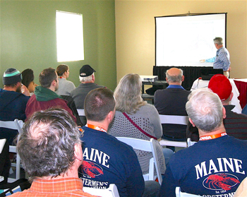
Jim Manning discusses the Environmental Monitoring on Lobster Traps (eMOLT) project during the Maine Fishermen’s Forum in early March. Laurie Schreiber photo.
The Environmental Monitoring on Lobster Traps (eMOLT) project now has 25 vessels equipped with satellite transmitters that send real-time data on bottom temperature, salinity, and current velocity to industry, science, and academic researchers.
The primary motivation for collecting eMOLT data is to improve ocean models, said James Manning, an oceanographer with the Northeast Fisheries Science Center (NEFSC) who gave an overview of the eMOLT program and other monitoring programs at the Maine Fishermen’s Forum in early March.
The eMOLT program has been collecting hourly bottom temperature at dozens
of sites off the coast of New England for nearly two decades and has documented variations over multiple time scales, including long-term temperature rise. In the past few years, with dozens of vessels fitted with microcomputers and satellite transmitters, nearly 10,000 hauls have automatically reported real-time bottom temperatures as soon as the gear arrives on deck, with results displayed in the wheelhouse and compared to both climatology and model simulations. Daily updates are posted on public websites.
The data is fed to NOAA’s Gulf of Maine Operational Forecast System, Manning said. The model can be applied to specific areas, he added.
“What we want to do is get your queries so we can focus in on exactly what you want,” he said to the audience.
According to NEFSC, the eMOLT project, which monitors the physical environment of the Gulf of Maine and the Southern New England shelf, offers participating fishermen the latest in low-cost instrumentation. In 2019, the database consisted of more than 7 million hourly records of temperature, 80,000 hourly records of salinity, and 750,000 satellite drifter fixes. Although the mission was originally motivated by lobster science, it has evolved over the years and makes the database accessible to the general public in the form of web served products and raw data.
New technologies to experiment with in 2020, said Manning, include wireless temperature probes that report to smartphones; and ultrasonic weather station instruments. Two boats are fitted with the latter so far, and plans are in the works to fit about a dozen more this year, he said.
“We want to get more fishermen to participate in these programs,” he added.
In a quest to minimize instrumentation cost, NEFSC has partnered with schools and local engineers in the private sector. That’s led to development of devices of interest to the oceanographic community in general. The first is a GPS drifter at nearly a third the cost of commercial units. The units have logged more than a million kilometers of ocean and are being used by dozens of other universities and research groups. Others include a real-time bottom temperature sensor that can be attached to fixed or mobile fishing gear and wirelessly transmits data to a shipboard system as it is hauled on deck.